
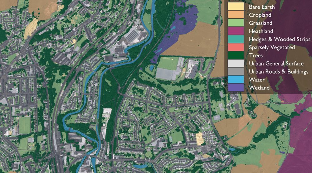
Ordnance Survey (OS) has launched a new land data tool aimed at helping developers meet biodiversity requirements while supporting the government’s target of building 1.5m homes.
The organisation says its Enhanced Land Cover (ELC) Beta product has been designed to help developers in England comply with Biodiversity Net Gain (BNG) rules, which require a 10% improvement in habitats as part of planning applications.
Under legislation introduced by the Department for Environment, Food & Rural Affairs (Defra), developers must assess baseline habitats, submit biodiversity gain plans and maintain improvements for at least 30 years. The government recently confirmed that BNG requirements will extend to Nationally Significant Infrastructure Projects from November.
OS said the new dataset could streamline this process by combining multiple sources of geospatial information into a single tool. The ELC product integrates topographic data from the OS National Geographic Database with aerial imagery, terrain modelling and third-party datasets, including Natural England’s Living England data, the Rural Payments Agency’s Crop Map of England and the UKHab habitat classification system.

UKHab provides the standard framework underpinning Defra’s biodiversity metric, which developers must use to measure gains. By consolidating these datasets, OS said the tool enables users to carry out early-stage habitat assessments both at a desktop level and in the field.
The organisation added that developers, landowners and ecologists can use the data to better understand land composition at scale before undertaking more detailed site surveys. Utility company Wessex Water has already applied the dataset to assess biodiversity across hundreds of sites and incorporate findings into long-term BNG planning.
Technology firm Linckia, part of a recent Geovation Accelerator cohort, has integrated OS ELC data into its own biodiversity tools. The company delivers the data through its Habitat Fabric dataset and BNG application, hosted on the ESRI platform.
Co-founder Luke Chittock said: “We really like OS Enhanced Land Cover, which we integrate into Linckia’s BNG solution on the ESRI platform. It gives us a scalable, authoritative, and auditable approach that we can trust, delivering better outcomes for our customers. Applying our ecology expertise to the data to create Habitat Fabric, we have seen a 40% reduction in data processing costs from earlier approaches, rising to 90% reduction when compared to processing imagery for the same outcomes.”
OS said the efficiency gains could be significant as demand for ecological expertise grows.
Dr Jack Parkin, product manager for the built and natural environment at OS, said: “The government’s home-building target, combined with Defra’s BNG legislation, has made a market condition where ecologists are in high demand.
“One of the benefits of OS Enhanced Land Cover is to boost the productivity of those ecologists and to make their time count. We aggregate multiple geospatial datasets together to provide a provisional assessment of habitats on the ground which saves ecologists time both in desktop analysis and pre-screening in the field. This can shave days, or even weeks, from development times, and with 1.5m homes in the pipeline, that could really add up.”
Beyond housing, OS said the dataset could support wider environmental planning, including rewilding projects, flood risk management and the creation of green corridors.
Read next: Lucy Developments appoints TALO for Herts housing scheme
Are you a building professional? Sign up for a FREE MEMBERSHIP to upload news stories, post job vacancies, and connect with colleagues on our secure social feed.
