
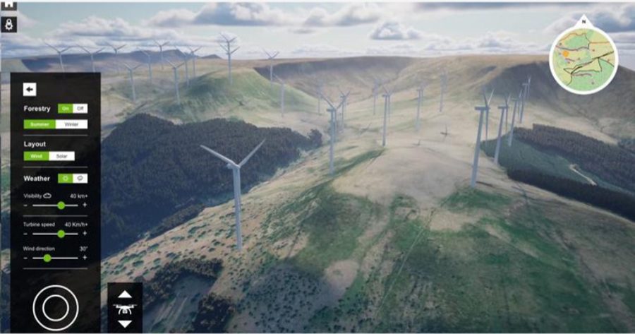
An environmental consultancy has turned to 3D gamer tech to create a visualisation tool intended to help build greater public trust and engagement during infrastructure project consultations.
LUC has built its immersive tool, ENGAGE3D on advanced game-engine technology to produce interactive 3D models of proposed developments in real world landscapes on a touchscreen TV. At consultation events, stakeholders can move freely through the site at eye level, switch to a virtual drone view, and compare alternative layouts and scenarios.
The tool is said to be fully customisable, with users able to explore landmarks or custom viewpoints, toggle seasons, weather, visibility, turbine speeds and more, and access integrated supporting media and annotations.
Each model combines multiple datasets – including LiDAR terrain models, aerial imagery, the National Tree Map, and photography – to reflect real-world conditions.

Rob Booth, chief executive at LUC, said: “[W]e believe that the best projects start with listening. Effective consultation builds understanding, strengthens trust, and helps communities feel part of shaping their future.
“This is why we developed ENGAGE3D – an integrated service backed by 60 years of environmental consultancy expertise and robust GIS data. It’s a tool that will facilitate meaningful conversations about development proposals and place communities into the heart of decision making.”
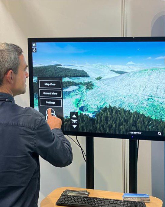
Publically-owned renewable energy developer, Trydan Gwyrdd Cymru (TGC) in Wales is one of the first adopters of ENGAGE3D. The company used the technology to consult with communities on a series of new wind farms across the country. The tool enables residents to explore landscapes within an average 10-kilometre radius of each site.
TGC commissioned LUC to apply the ENGAGE3D technology to help communities better understand the visual change that could occur if proposed sustainability infrastructure in their area proceeds to construction and operation.
Dr Catrin Ellis-Jones, head of public involvement at TGC, said: “The 3D digital model is an excellent tool for visualising what a project can look like in the local landscape from close up, or from kilometres away. It helps provide context and illustrates how some features, such as trees and buildings, or topographic effects, mean the turbines are less apparent when observed from certain locations, and more obvious from other viewpoints.
“It allows direct comparison with existing turbines where they exist, which people are often keen to see. It makes the data and designs we draw up easily accessible to a wide range of people, young and older, and in turn helps us gather informed and specific feedback on our proposals.
“It was appreciated by local people and stakeholders who participated in our early stage project-introduction events, and the 3D model will be updated through the iterative and consultative planning process, so people can also ‘see’ our designs evolve.”
Read next: Seddon’s Hodkinson appointed chair of Mates in Mind
Are you a building professional? Sign up for a FREE MEMBERSHIP to upload news stories, post job vacancies, and connect with colleagues on our secure social feed.
