
Autonomous localisation advances enable mobile robots to cross complex, evolving digital construction and infrastructure environments.
Autonomous and semi-autonomous machines are increasingly deployed across the digital construction sector for surveying, inspection, logistics, and asset monitoring. These mobile robots must constantly estimate their position and orientation to navigate safely and deliver accurate data.
However, satellite navigation signals often degrade near buildings, tunnels, and industrial sites, and they are unavailable indoors. In such environments, robots rely on onboard sensors and localisation algorithms rather than GPS alone. When localisation fails—such as after a robot is moved unexpectedly or loses its positional data—the machine faces the well-known “kidnapped robot” problem, where it must rediscover its position without knowing its starting point.
A research team at Miguel Hernández University of Elche (UMH) has developed a solution that enables robots to recover from such scenarios using a hierarchical 3D LiDAR localisation system suited to large and changing environments common in infrastructure and construction projects.
AI-Powered 3D LiDAR localisation
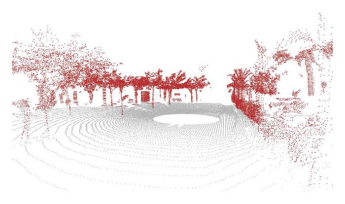
The research, published in International Journal of Intelligent Systems, introduces a framework called MCL-DLF (Monte Carlo Localization – Deep Local Feature). The system uses 3D LiDAR point clouds to allow robots to interpret their surroundings even after seasonal or structural changes.
Rather than depending on a known starting pose, the robot analyses structural elements such as buildings and vegetation to perform coarse localisation. Once it identifies its approximate area, the system switches to fine localisation by examining smaller distinguishing details to calculate precise positioning.
Lead author Míriam Máximo explains: “This is similar to how people first recognize a general area and then rely on small distinguishing details to determine their precise location.”
The project was directed by Mónica Ballesta and David Valiente at the Engineering Research Institute of Elche (I3E). Co-authors also include Antonio Santo and Arturo Gil.
Deep learning allows the robot to automatically determine which environmental features are useful for localisation instead of relying on manually programmed rules. These learned features are then combined with probabilistic Monte Carlo localisation, maintaining multiple hypotheses about the robot’s pose until sufficient evidence confirms the correct one.

Robust navigation in changing environments
A key obstacle in autonomous robot navigation is environmental variability. Outdoor construction and infrastructure sites evolve due to seasonal vegetation growth, lighting differences, or structural modifications.
The UMH team validated their system over several months in both indoor and outdoor campus environments, showing improved position accuracy compared with traditional localisation techniques. Importantly, localisation performance remained stable despite environmental changes, demonstrating suitability for long-term deployment.
For digital construction robotics, this robustness is critical. Machines deployed for infrastructure inspection or site monitoring must operate reliably across project phases that may span months or years.
Applications
Reliable localisation underpins a wide range of autonomous operations, including construction site robotics, logistics automation, infrastructure inspection, environmental monitoring, and autonomous vehicles operating in complex built environments.
For digital construction, logistics, and inspection robotics, technologies like MCL-DLF represent practical progress toward resilient, infrastructure-independent navigation in dynamic, real-world environments.
Advances in AI-driven LiDAR localisation will support safer autonomous inspection, logistics, and digital construction robotics, enabling dependable navigation performance despite environmental change and infrastructure complexity.
The research was funded by Spanish Ministry of Science, Innovation and Universities and the State Research Agency, co-funded by the European Regional Development Fund, alongside support from Generalitat Valenciana through its PROMETEO programme.
Read next: Mapping the future – Build in Digital
Are you a building professional? Sign up for a FREE MEMBERSHIP to upload news stories, post job vacancies, and connect with colleagues on our secure social feed.
