
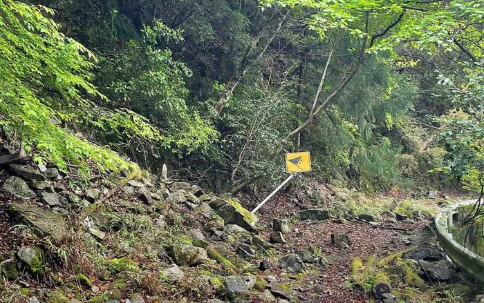
Drone LiDAR surveys are transforming debris-flow hazard assessment by quantifying long-term debris supply from steep mountain slopes.
Debris supplied by rockfall and slope processes plays a central role in determining the frequency and magnitude of debris flows. However, measuring debris accumulation over multiple decades has historically been difficult due to limited long-term monitoring methods.
A recent study titled “An Abandoned Road as a Debris Trap: Estimating Debris-Supply Rate from Steep Slopes Based on UAV-LiDAR DEMs” demonstrates how UAV-LiDAR topographic surveys of abandoned mountain roads can provide a new dataset for long-term debris supply estimation and debris-flow hazard analysis.
Researchers conducted a high-resolution UAV-LiDAR survey along a closed section of Shizuoka Prefectural Road 288 near the Shizuoka–Nagano prefectural border in Japan. The road became impassable following a disaster in 1991 and has since accumulated rockfall-derived debris. These deposits created a natural record of multi-decadal sediment accumulation on road surfaces.

Abandoned mountain roads as natural debris monitoring sites
Using UAV-LiDAR digital elevation models (DEMs), the research team divided the road into segments and examined how slope geometry influenced debris accumulation. Their analysis identified a strong correlation between steeper mean slope angles, larger contributing areas, and increased debris supply rates.
The findings estimate that headwater slopes in the region supply approximately 70–93 cubic metres of debris annually. According to the research team, this volume indicates that “a sufficient volume of material to trigger a debris flow can accumulate within several decades.”
Implications for debris-flow hazard forecasting
Across Japan’s mountainous regions, road realignment has led to a growing number of abandoned mountain roads. These corridors have rarely been used for scientific monitoring despite their ability to capture debris from surrounding slopes.
The study demonstrates that UAV-LiDAR surveys of abandoned infrastructure can generate baseline datasets for debris-flow forecasting, landslide risk modelling, and slope stability assessment.
The research received funding from the Japan Society for the Promotion of Science Grants-in-Aid for Scientific Research (JP19H01371 and JP22H00750), led by principal investigator T. Hattanji.
UAV-LiDAR surveys of abandoned mountain roads provide measurable evidence of long-term debris supply, strengthening debris-flow forecasting, hazard mapping, and digital terrain analysis for infrastructure and slope risk management.
Read next: UK’s first hydrogen-fuelled asphalt production trial – Build in Digital
Are you a building professional? Sign up for a FREE MEMBERSHIP to upload news stories, post job vacancies, and connect with colleagues on our secure social feed.
